Explore the Hawaiian islands with our interactive maps.
Find all the great beaches, attractions and activities and see the location of vacation rentals. Zoom in for a closer look and view the panoramic photos!
Check out these exciting features and more.
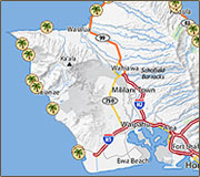
Interactive Map - Screenshot
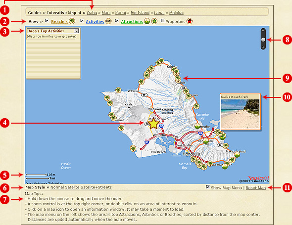
Features:
- Title Bar - Lists the maps available. Click a link to change to another island.
- Tool Bar - Check box to show icons on the map. Uncheck box to hide icons.
Click on a underlined attraction, eg. Beaches, and the map menu will show nearby beaches and their distances.
Tip: By hiding some of the icons the map becomes less cluttered. The remaining icons will become larger and easier to click on.
When going to the Interactive Maps directly (not doing a Rental Search first), the Properties checkbox is not active:
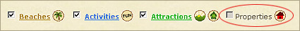
To activate and view properties on the map:
- Start a Rental Search first and select an island.
- A list of properties will be displayed. This is the search results page.
Click on "Map View" in the right hand corner.
Search Results Page
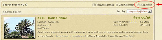 Click to
map properties
You will see the red house icons
 on the map now, see screenshot below.
The properties checkbox is now activated. Hide all properties by unchecking the box.
Properties Added to Map
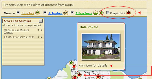

Check box to show
or uncheck box to
hide properties
Click on the icon
to view more details
Clicking will open up the house details:
Expanded View - House Details
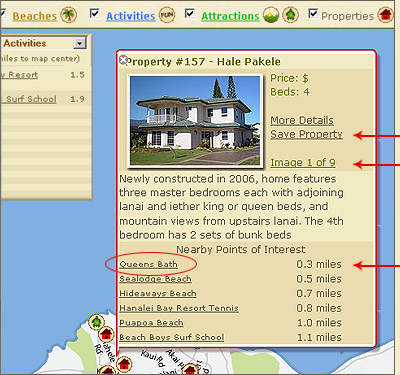
Save properties to review later
Keep clicking to view more photos
Click link to open photos of attraction
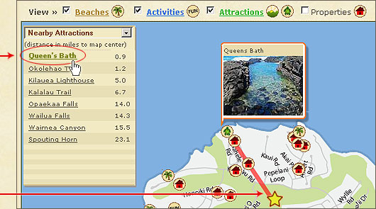
- Map Menu - Lists the top nearby attractions or activities in the area or around a rental property.
Distance is show in miles.
Put your mouse over an item in the map menu and you will see the distance (in miles) and red line pointing to it on the map.
The distance is calculated relative to the star, which is the center point on the map.
Tip: Place mouse somewhere on map (not on an icon), click and drag. Dragging will move the map and star.
Look at the map menu, the distances are automatically updated!
Place your mouse
over a link
The red line points to
the activity or attraction
Distance is calculated
from the star
Clicking on the Queen's Bath link or icon will open up the following views:
Expanded View - Single Photos
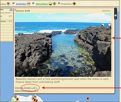
Photo changes when clicking
the link - Image 1 of 1
Click on the link to view more photos
Expanded View - Panorama Photos
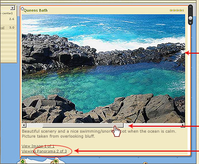
Panorama Photo
Click and drag bar to view
entire panorama photo
Click link to view more
panorama photos
- Center Point - The star is the center reference point. e.g. The beach is 3 miles from the star.
- Map Scale - Gives you an idea of
distances.
- Map Style - Click to switch between three map styles:
Normal
Satellite
Satellite + Streets
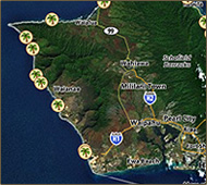
Satellite imagery at maximum zoom is very good and gives one an interesting view
of the surroundings. Keep in mind that the imagery is about 3 years old and doesn't
show new construction.
- Tips - Tips on how to move around the map.
- Zoom Bar - Click to zoom in and out of the map.
- Icons - There is one icon for each beach, activity or attraction. The icons show where it is located on the island. Click to zoom in.
Rental Properties
 Condos
 Property but exact address unknown*
 Beaches
 Activities
 Scenic Attractions
 Ocean Attractions
*When the exact address is not available, a property is placed at the town center
(and grouped with others).
- Photo Viewer - Place your mouse over an icon. A small photo of the beach or attraction will be displayed. Click an icon to view photos.
There will be large single and panoramic photos. Go back to map feature #3 to view an example of the expanded window.
- Show Map Menu - Check box to show or uncheck box to hide the drop down menu.
Located in the top left hand corner, this menu lists the top nearby attractions or activities. It is map feature #3 on the above screenshot.
Reset Map - Resets zoom level. View the entire island and start again.